3D Geological Mapping for Smarter Exploration Decisions
Transform satellite-derived geological data into interactive 3D models that help exploration teams visualize, analyze, and prioritize subsurface targets with greater confidence. Powered by CC GeoLab™, our advanced geological mapping platform delivers real-time geospatial intelligence for mineral exploration, groundwater assessment, and resource evaluation projects worldwide.

What Is CC GeoLab™?
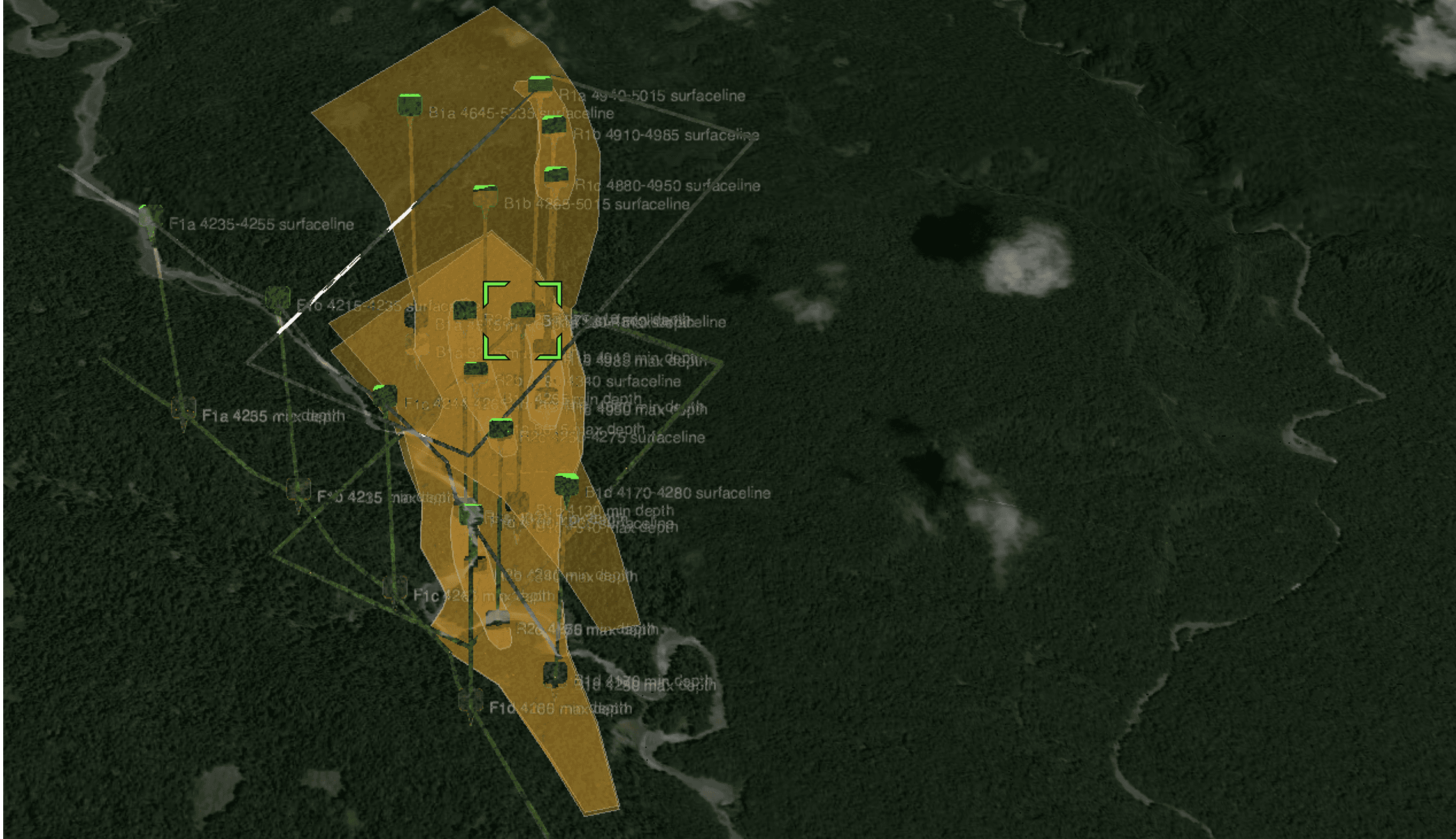
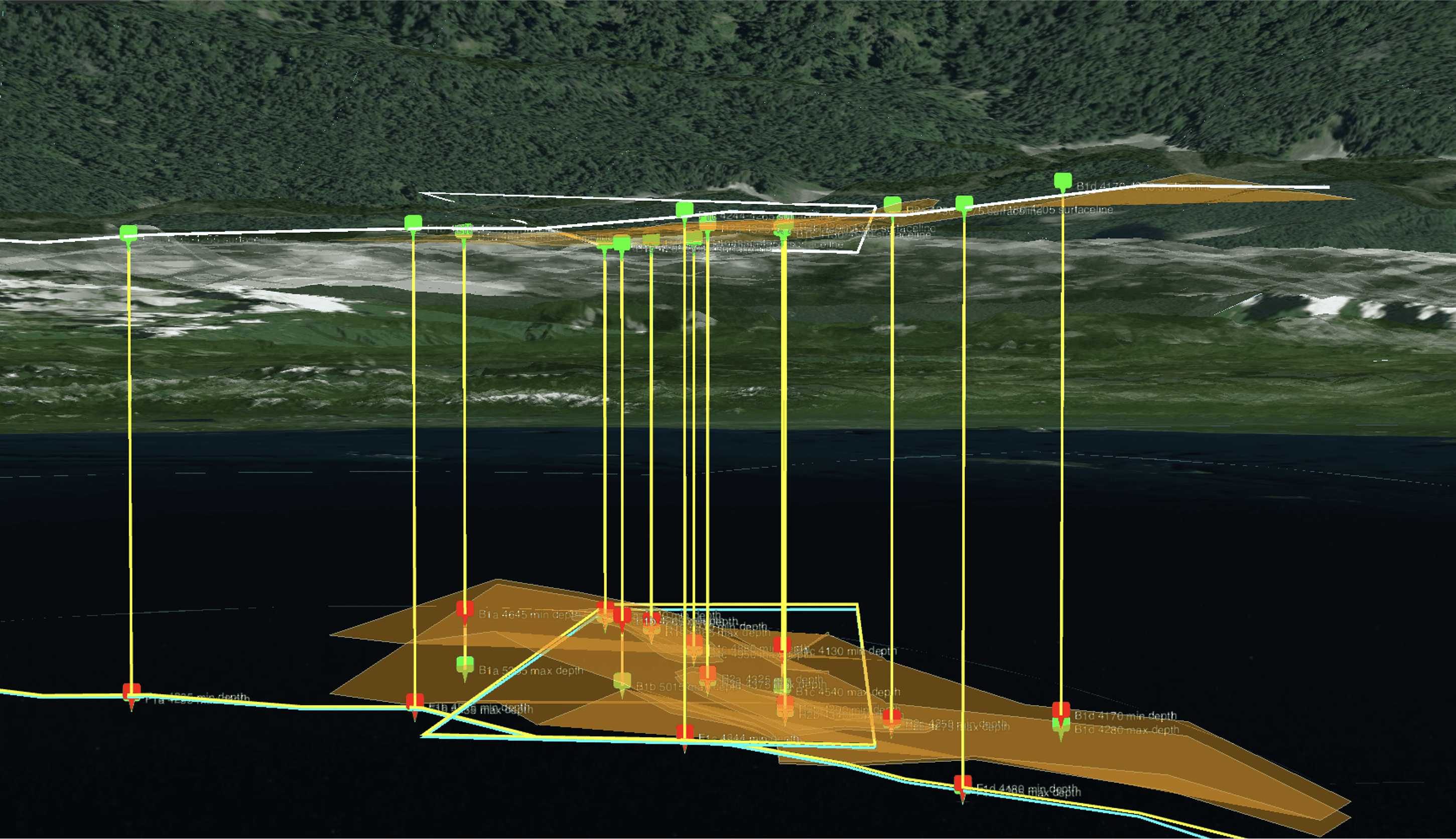
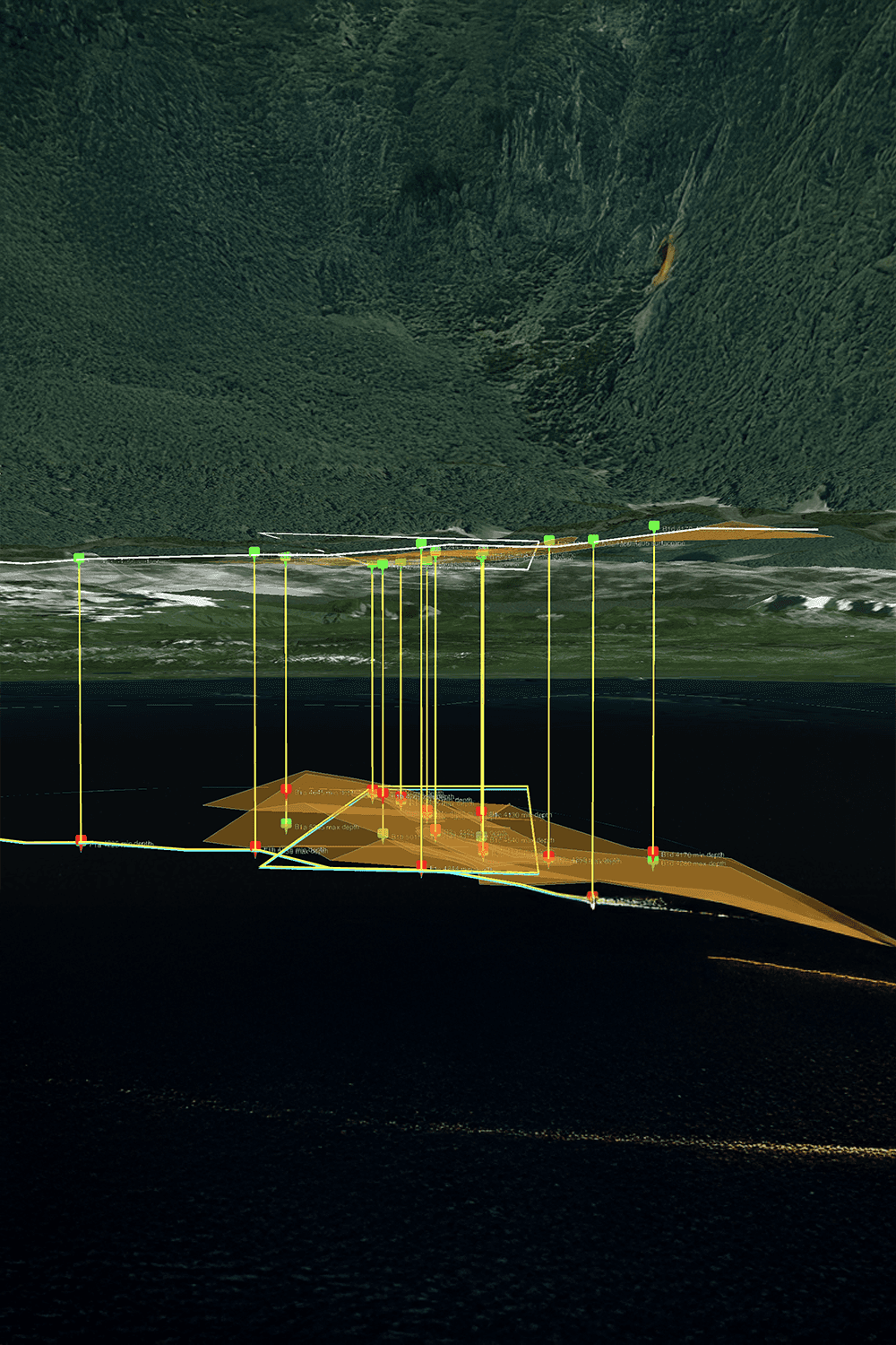
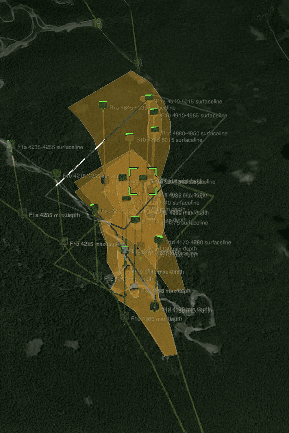
CC GeoLab™ is a proprietary 3D geological mapping platform designed to transform complex exploration data into clear, interactive visualizations. Built to support modern mineral exploration workflows, the platform combines satellite-derived datasets, geological interpretations, topographic information, and subsurface models into a single environment. This allows exploration teams to better understand geological structures, anomalies, and target zones before crews mobilize to the site.
From Exploration Data to Geological Intelligence
GeoLab™ helps users visualize:
Mineral target zones
Geological formations
Subsurface anomalies
Structural trends
Topographic features
Groundwater systems
Using advanced geospatial modeling and interactive 3D visualization, exploration teams can evaluate opportunities more efficiently and communicate findings more effectively.
Designed for Exploration Teams
GeoLab™ supports:
Mineral Exploration
Visualize exploration targets and geological structures in a dynamic 3D environment.
Oil & Gas Evaluation
Analyze subsurface features and exploration opportunities with greater spatial context.
Groundwater Assessment
Map aquifers, underground water systems, and geological conditions that influence water resources.
Resource Project Planning
Improve communication between technical teams, investors, and decision-makers through clear geological visualization.


Key Capabilities
Interactive 3D Geological Mapping
Explore geological data in a fully navigable environment.
Real-Time Data Access
Review exploration results and geological interpretations from anywhere.
Advanced Geospatial Modeling
Integrate multiple geological datasets into a single visualization platform.
Exploration Target Visualization
Prioritize opportunities using layered geological intelligence.
Cesium-Powered Performance
Built using modern geospatial visualization technology for fast and responsive performance.
CC GEOLAB™
Turning Exploration Data Into Action
Exploration generates large amounts of data.
GeoLab transforms that information into practical geological intelligence, helping organizations move from interpretation to decision-making with greater speed and confidence.
Real-time geology meets AI to accelerate global resource exploration.
From terrain to tunnel, GeoLab maps what others can’t reach.
Satellite scans. Subsurface data. Smarter exploration starts with CC GeoLab.


