Request a Consultation
Download Technical Overview

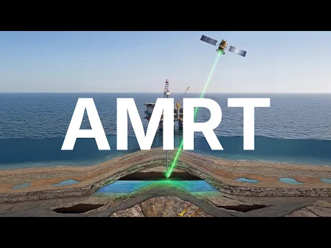
HOW AMRT HELPS TO DISCOVER OILD & GAS
Built on Decades of Geological Expertise
CC Explorations has spent decades developing and refining its methodology through worldwide survey deployment, combining geological expertise with continuous technical development across diverse exploration environments.
20+
Years of Development
Built through continuous research and real-world field application.
50+
Countries Deployed
Applied across exploration projects in diverse geological environments.
1,000+
A Number of Surveys
Completed across exploration initiatives worldwide.
up to 93%
Reported Accuracy
Demonstrated correlation across completed exploration survey projects.
PROBLEMS
Even the Strongest Exploration Programs Still Face Uncertainty
In oil & gas exploration, even well-researched drilling targets can carry uncertainty—and small mistakes in early decision-making can create significant operational and financial consequences.
Geological Uncertainty Remains
Even after extensive geological interpretation and target analysis, uncertainty often remains before drilling programs move forward.
Costly Non-Productive Wells
Drilling low-confidence targets can lead to dry wells, resulting in substantial financial loss and wasted exploration investment.
Capital Is Committed Too Early
Exploration programs often require major capital allocation before teams have enough confidence in final drilling targets.
Unnecessary Operational Impact
Incorrect drilling decisions can waste valuable time, field resources, and create avoidable environmental disturbance in exploration areas.
Solutions
An Additional Layer of Confidence Before Drilling Programs Move Forward
CC Explorations uses its proprietary AMRT™ satellite survey methodology to help oil & gas teams validate hydrocarbon targets earlier, strengthen pre-drilling decision-making, and allocate exploration resources with greater confidence.
Validate High-Potential Targets Earlier
Assess promising hydrocarbon targets earlier, before drilling programs require significant operational commitment.

Satellite-derived target intelligence
Strengthen Existing Geological Analysis
Independent survey intelligence complements geological interpretation and supports more confident target evaluation.
Reduce Unnecessary Drilling Activity
Avoid allocating resources toward lower-confidence drilling opportunities that may not produce viable results.
Allocate Capital More Efficiently
Focus operational time, budget, and field resources on higher-confidence exploration opportunities.
How It Works
Designed to Fit Into Your Existing Exploration Workflow
CC Explorations works alongside your existing oil & gas exploration process, delivering independent survey intelligence that helps support drilling decisions before significant capital is committed.
Survey Timeline
A clear remote sensing process from initial survey request to technical delivery.

01 2D Mapping in Google KMZ Format — Detailed two-dimensional maps highlighting significant geological features.
02 Identification of Trap & Reservoir Boundaries — Determine relative boundaries of identified traps and reservoir distribution.
03 Precise GPS Locations for Drilling & Testing — Recommended coordinates based on survey findings.
04 Detailed Depth Metrics for Drill Points — Estimated depth measurements from surface to target formations.
05 Mapping of Fault Feeds & Horizons — Illustrate migration pathways, horizon continuity, and spatial relationships.
06 Targeted Drilling Within Reservoir Zones — Recommend focused drilling locations within identified trap systems.
07 Depth Metrics for Reservoir Drill Points — Depth measurements for drill points within reservoir horizons.
08 Summary of Findings & Recommendations — Concise findings and practical recommendations for future activity.
How AMRT™ Supports Smarter Exploration Decisions
AMRT™ is CC Explorations’ proprietary satellite-based technology that provides an independent layer of subsurface intelligence. It complements traditional exploration methods by helping identify geological anomalies, estimate relative depths, and prioritize exploration targets before field operations begin.
Real Projects. Proven Results.
While drilling validation may take years in oil & gas exploration, AMRT has already been applied across a range of real-world exploration projects.
Note: Clients typically prohibit CC from publicly disclosing their results.
Burkina Faso Project
AMRT was utilized as part of an advanced exploration workflow to identify geological anomalies in a high-priority exploration region.
Mining · Gold · Burkina Faso
Read More →

History Channel Yamashita’s Gold Project
AMRT™ technology was used during a documentary exploration project to investigate historical treasure locations and support subsurface target identification within the Philippines.
Mining · Gold · PHILIPPINES
Read More →


Forks of Salmon Project
Remote sensing analysis identified geological subsurface features and helped validate exploration assumptions through satellite-derived survey intelligence.
Mining · Gold · CALIFORNIA, US
View Project →

Golden Unicorn Project
Satellite-based remote sensing analysis identified valuable geological features later validated through field exploration.
Mining · Gold · OREGON, US
View Project →
See If AMRT Is the Right Fit for Your Project
Submit your project area for a technical review. Our team will evaluate whether AMRT™ can help prioritize exploration targets and reduce uncertainty before significant field investment.
Questions
Direct answers for exploration teams who need facts, not fluff.
How accurate is AMRT™ Technology?
Can AMRT™ replace seismic surveys?
How long does a typical survey take?
What deliverables are included?
Is physical site access required?